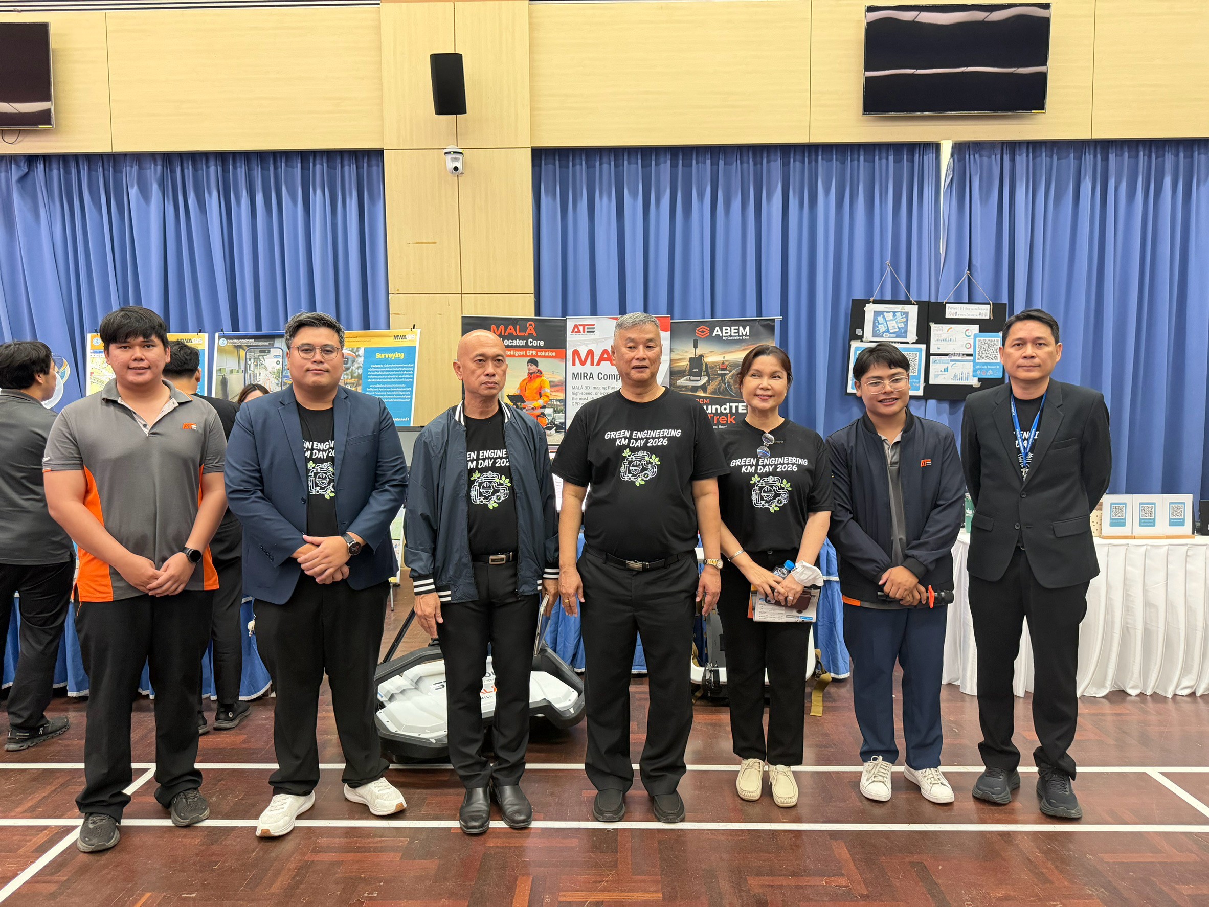
🏛️ KM Day สายงานวิศวกรรม การประปานครหลวง คืออะไร?🏛️ What is MWA Engineering KM Day?
KM Day (Knowledge Management Day) สายงานวิศวกรรม คือกิจกรรมประจำปีที่ การประปานครหลวง (MWA) จัดขึ้นเพื่อรวบรวมองค์ความรู้ นวัตกรรม และผลงานทางวิศวกรรมจากทีมงานภายในและหน่วยงานภายนอกมาแบ่งปันกัน โดยมีการนำเสนอผลงาน "1 ฝ่าย 1 นวัตกรรม" และการประกวดแข่งขันด้านความรู้ เพื่อยกระดับมาตรฐานงานวิศวกรรมประปาของไทย
KM Day (Knowledge Management Day) for the Engineering Division is an annual event organized by the Metropolitan Waterworks Authority (MWA) to gather and share knowledge, innovations and engineering achievements from both internal teams and external partners. It features a "1 Department, 1 Innovation" showcase and knowledge competitions — driving higher standards in Thailand's waterworks engineering.
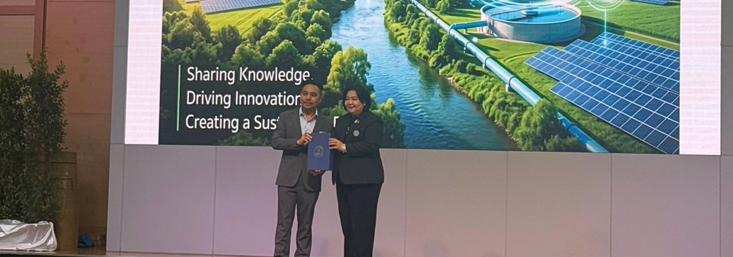
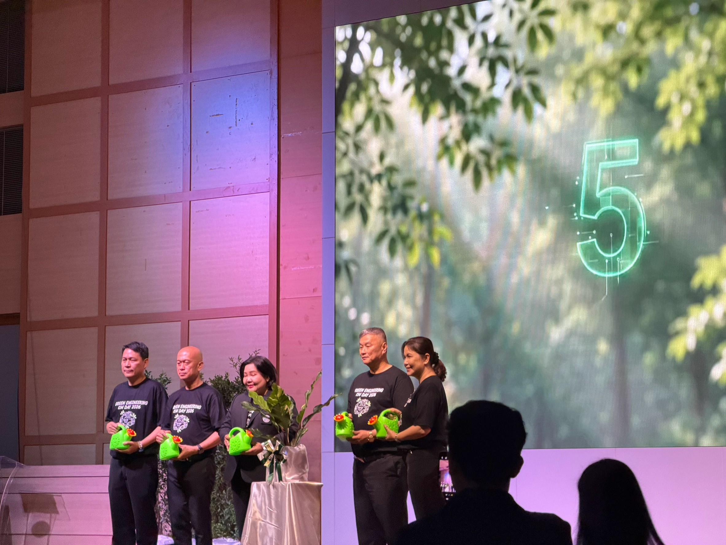
ในปีนี้ งานจัดขึ้นโดยมี นางสาวสุวรา ทวิชศรี ผู้ว่าการการประปานครหลวง เป็นประธานเปิดงาน และ นายสรรค์ชัย พงศ์พุทธชาติ รองผู้ว่าการ (วิศวกรรม) กล่าวรายงานวัตถุประสงค์การจัดงาน โดยมีผู้บริหารและวิศวกรจากทั้งหน่วยงานภายในและภายนอกสายงานวิศวกรรมร่วมงานอย่างคับคั่ง
This year's event was presided over by Ms. Suwara Thawichsri, Governor of MWA, with Mr. Sanchai Pongphutthachat, Deputy Governor (Engineering) delivering the opening report. Executives and engineers from both internal divisions and external agencies attended in force.
📋 กำหนดการงาน📋 Event Schedule
| เวลาTime |
กิจกรรมActivity |
| 08:30 – 09:00 |
ลงทะเบียนผู้เข้าร่วมงาน / ชมบูธนวัตกรรมจากหน่วยงานภายนอกRegistration / Visit external innovation booths |
| 09:00 – 09:30 |
พิธีเปิดกิจกรรม KM Day สายงานวิศวกรรม
– นายสรรค์ชัย พงศ์พุทธชาติ รองผู้ว่าการ (วิศวกรรม) กล่าวรายงาน
– นางสาวสุวรา ทวิชศรี ผู้ว่าการการประปานครหลวง กล่าวเปิดงาน และมอบของที่ระลึกแก่หน่วยงานภายนอก
Opening Ceremony
– Mr. Sanchai Pongphutthachat, Deputy Governor (Engineering) — Opening Report
– Ms. Suwara Thawichsri, MWA Governor — Opening Speech & Gift Presentation to External Agencies
|
| 09:30 – 10:00 |
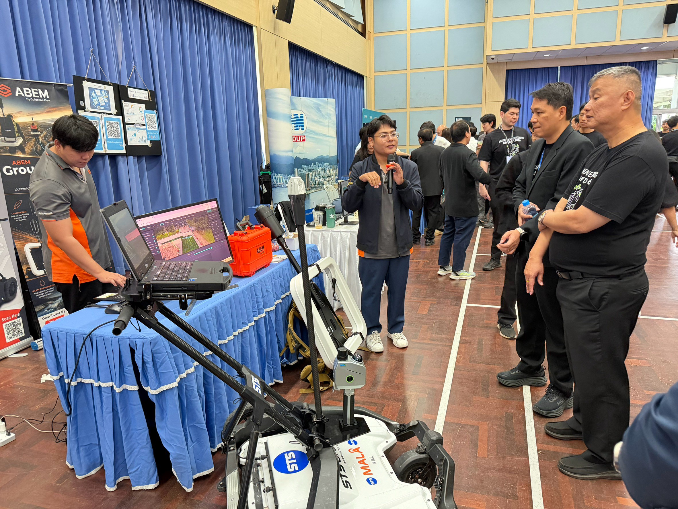
ผู้บริหารร่วมชมผลงานนวัตกรรมจากหน่วยงานภายในสายงานวิศวกรรมและหน่วยงานภายนอกExecutives tour innovation exhibits from engineering divisions and external agencies |
| 09:30 – 10:00 |
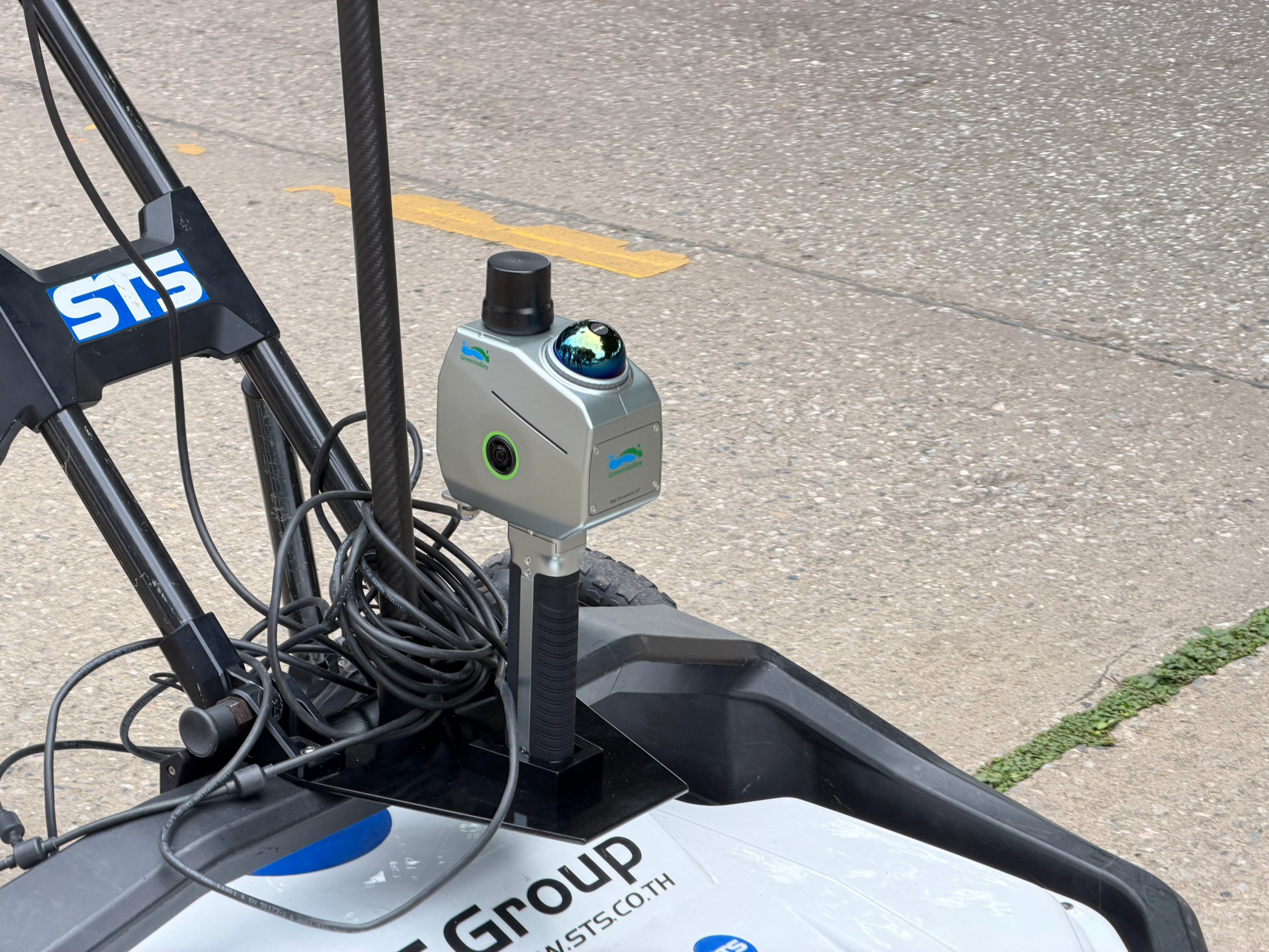
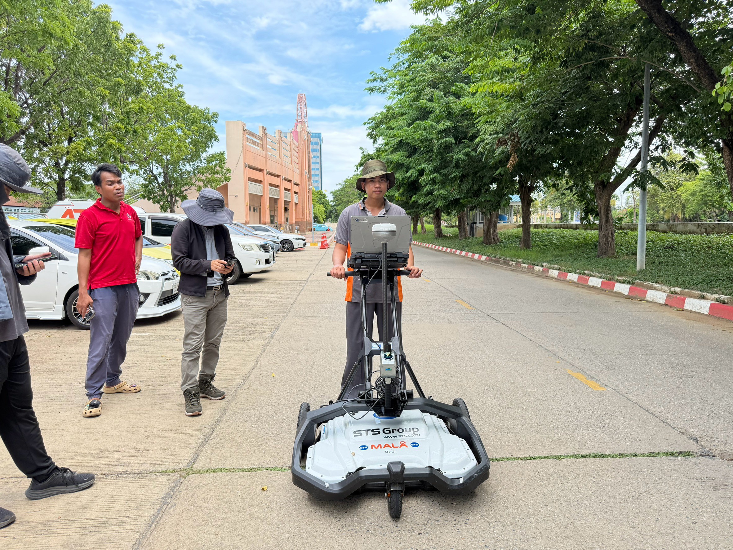
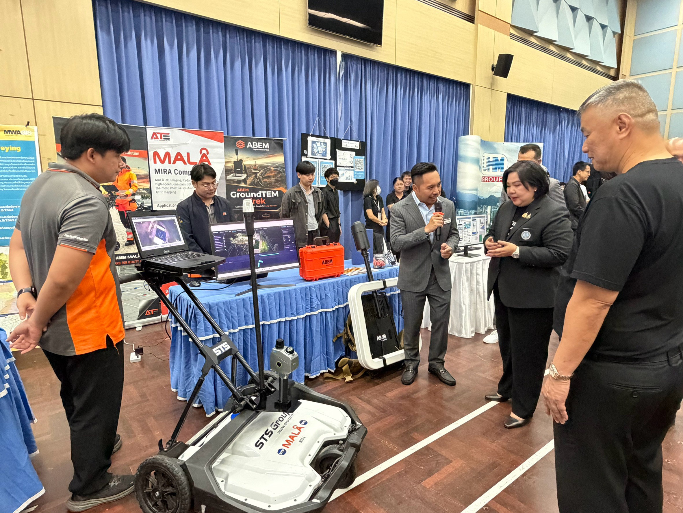
🔍 ATE สาธิตเทคโนโลยี GPR+SLAM สำรวจท่อประปาใต้ดิน ณ บูธหน่วยงานภายนอก🔍 ATE demonstrates GPR+SLAM technology for underground pipe survey at the external agency booth |
| 10:00 – 11:00 |
การนำเสนอผลงาน 1 ฝ่าย 1 นวัตกรรม สายงานวิศวกรรม1 Department, 1 Innovation Presentation — Engineering Division |
| 11:00 – 11:30 |
พิธีมอบรางวัล: การประกวดผลงาน 1 ฝ่าย 1 นวัตกรรม / บทความองค์ความรู้ OPA & Lesson Learned / KM RewardsAward Ceremony: Innovation Competition / OPA Knowledge Article & Lesson Learned / KM Rewards |
| 11:30 – 12:00 |
จับฉลากของที่ระลึกสำหรับผู้เข้าร่วมงานLucky draw for attendees |
| 12:00 |
สิ้นสุดกิจกรรมEnd of Event |
📡 เทคโนโลยี GPR+SLAM คืออะไร และทำไมต้องใช้คู่กัน?📡 What is GPR+SLAM and Why Do They Work Together?
หลายคนอาจสงสัยว่า GPR กับ SLAM คือเทคโนโลยีคนละชนิดกัน แล้วทำไมถึงต้องใช้คู่กัน? คำตอบอยู่ที่ข้อจำกัดของแต่ละเทคโนโลยีที่ไปเติมเต็มซึ่งกันและกัน
You might wonder: GPR and SLAM are completely different technologies — so why must they work together? The answer lies in how their individual limitations perfectly complement each other.
เทคโนโลยีทั้งสองชนิด — Technology Breakdown
📡
GPR — Ground Penetrating Radar
ส่งคลื่นแม่เหล็กไฟฟ้าลงใต้ดิน รับสัญญาณสะท้อนกลับจากท่อ, สายไฟ หรือโพรง แสดงผลเป็น Radargram หรือ Depth Profile บอกได้ว่ามีอะไรอยู่ "ที่ความลึกเท่าไร" แต่ไม่รู้ว่าตำแหน่ง XY บนพื้นผิวอยู่ที่ใด
Emits electromagnetic waves into the ground and captures reflections from pipes, cables or voids. Produces a Radargram or Depth Profile — revealing "what is there and at what depth" — but cannot determine the XY position on the surface.
🗺️
SLAM — Simultaneous Localization and Mapping
เทคโนโลยีที่ทำให้ระบบสามารถ "รู้ตำแหน่งตัวเอง" และ "สร้างแผนที่พื้นที่" ไปพร้อมกันแบบ Real-time โดยไม่ต้องพึ่ง GPS ผ่าน Sensor Fusion (LiDAR, IMU, Wheel Encoder) เหมาะมากในสภาพแวดล้อมที่ GPS ไม่เสถียร เช่น เขตเมืองหนาแน่น
Enables a system to simultaneously "know its own position" and "build a map of the environment" in real-time — without GPS — through Sensor Fusion (LiDAR, IMU, Wheel Encoder). Ideal where GPS is unreliable, such as dense urban areas.
GPR + SLAM = แผนที่ท่อ 3D ที่แม่นยำ
เมื่อนำ GPR (รู้ว่ามีอะไรอยู่ที่ความลึกเท่าไร) มารวมกับ SLAM (รู้ว่า scan อยู่ที่พิกัด XY ไหน) ผลลัพธ์คือ แผนที่ 3D ของสาธารณูปโภคใต้ดินทั้งหมด — ท่อประปา, ท่อก๊าซ, สายไฟ — พร้อมพิกัดที่แม่นยำ โดยไม่ต้องขุดสำรวจเลย
Combining GPR (knowing what is at a given depth) with SLAM (knowing exactly which XY coordinate is being scanned) produces a complete 3D map of all underground utilities — water pipes, gas lines, cables — with precise coordinates, entirely non-destructively.
ทำไม GPR เพียงอย่างเดียวไม่พอ?Why isn't GPR alone sufficient?
GPR ตัวเองบอกได้เพียงว่า "มีท่ออยู่ที่ความลึก 1.2 เมตร" แต่ไม่สามารถบอกได้ว่าจุดที่ทำการ scan นั้นอยู่ที่ตำแหน่งใดบนพื้นที่สำรวจ หากพึ่ง GPS อย่างเดียว ในสภาพแวดล้อมเมืองที่มีตึกสูง ต้นไม้ หรือสัญญาณรบกวน GPS จะมีความคลาดเคลื่อนสูงถึง 2–5 เมตร ซึ่งมากเกินไปสำหรับการทำ Utility Map ที่ต้องการความแม่นยำระดับเซนติเมตร
GPR alone can only tell you "there is a pipe at 1.2 m depth" — it cannot pinpoint where on the survey area that scan was taken. Relying solely on GPS in urban environments with tall buildings, trees or signal interference introduces errors of 2–5 metres, far too large for a Utility Map requiring centimetre-level accuracy.
SLAM แก้ปัญหานี้โดยติดตามตำแหน่งของระบบสำรวจจาก Sensor ภายใน โดยไม่พึ่งสัญญาณภายนอก ทำให้ระบบสามารถบันทึก XY coordinate ที่แม่นยำสำหรับทุก scan point ของ GPR ผลลัพธ์คือ แผนที่ท่อ 3D ที่วิศวกรสามารถนำไปใช้งานได้จริง
SLAM solves this by tracking the survey system's position from internal sensors, independent of external signals — recording a precise XY coordinate for every GPR scan point. The result is a 3D pipe map that engineers can immediately put to practical use.
💧 ประโยชน์ของ GPR+SLAM สำหรับงานการประปา💧 GPR+SLAM Benefits for Waterworks Operations
สำหรับองค์กรอย่างการประปานครหลวงที่ดูแลเครือข่ายท่อน้ำใต้ดินในพื้นที่กรุงเทพมหานครและปริมณฑลกว่า 20,000 กิโลเมตร เทคโนโลยี GPR+SLAM มีประโยชน์โดยตรงหลายด้าน
For an organization like MWA managing over 20,000 km of underground water pipe networks across Bangkok and the metropolitan area, GPR+SLAM offers direct benefits across multiple areas.
-
1
สำรวจท่อโดยไม่ต้องขุดNon-destructive pipe survey
ประหยัดต้นทุนการขุดเจาะ ลดการรบกวนการจราจรและชุมชน ตรวจสอบได้รวดเร็วกว่าวิธีดั้งเดิมหลายเท่า
Eliminates excavation costs, minimizes traffic and community disruption, and is far faster than conventional methods.
-
2
อัปเดต As-Built Drawing ที่ถูกต้องAccurate as-built record update
ท่อประปาที่วางมาหลายสิบปีมักไม่มีแบบ as-built ที่ถูกต้อง GPR+SLAM สร้างข้อมูลแผนที่ดิจิทัล 3D ใหม่ที่แม่นยำและพร้อมนำเข้า GIS
Pipes installed decades ago often lack accurate as-built records. GPR+SLAM creates fresh, accurate 3D digital map data ready for GIS integration.
-
3
วางแผนซ่อมและขยายเครือข่ายท่อได้แม่นยำPrecise maintenance and network expansion planning
รู้ตำแหน่งท่อชัดเจนก่อนขุด ลดความเสี่ยงกระทบสาธารณูปโภคอื่น ประหยัดเวลาและงบประมาณในงานซ่อมแซม
Knowing pipe positions precisely before digging reduces the risk of damaging adjacent utilities and saves significant time and budget in repair operations.
-
4
ทำงานได้ในสภาพแวดล้อม GPS ไม่ดีOperates in GPS-denied environments
SLAM ทำงานได้แม้ในซอยแคบ ใต้สะพานลอย หรือบริเวณที่สัญญาณ GPS อ่อน ซึ่งพบได้บ่อยในพื้นที่ให้บริการของ MWA
SLAM functions even in narrow alleys, under overpasses or in areas with weak GPS signal — common conditions throughout MWA's service area.
🤝 ขอบคุณการประปานครหลวง🤝 Thank You, Metropolitan Waterworks Authority
ATE ขอขอบคุณ การประปานครหลวง (MWA) เป็นอย่างยิ่งที่ให้เกียรติเชิญเราเข้าร่วมงาน KM Day สายงานวิศวกรรมครั้งนี้ การได้นำเสนอเทคโนโลยี GPR+SLAM ต่อผู้บริหารและวิศวกรมืออาชีพของ MWA ถือเป็นโอกาสอันมีค่าในการแบ่งปันนวัตกรรมที่สามารถยกระดับงานสำรวจสาธารณูปโภคของประเทศไทยได้อย่างแท้จริง
ATE sincerely thanks the Metropolitan Waterworks Authority (MWA) for the honor of this invitation to Engineering KM Day. Demonstrating GPR+SLAM technology to MWA's executive team and professional engineers was a truly valuable opportunity to share innovations that can genuinely elevate underground utility surveying standards across Thailand.
ความสนใจและคำถามจากวิศวกรของ MWA ตลอดการสาธิตสะท้อนให้เห็นว่าประเทศไทยพร้อมที่จะก้าวสู่ยุคของการบริหารจัดการสาธารณูปโภคใต้ดินด้วยเทคโนโลยีที่ทันสมัยและแม่นยำ
The keen interest and questions from MWA's engineers throughout the demonstration reflect that Thailand is ready to move into an era of underground utility management driven by modern, precise technology.
🔭 พร้อมยกระดับงานสำรวจสาธารณูปโภคขององค์กรคุณ🔭 Ready to Elevate Your Utility Survey Operations?
ATE พร้อมให้คำปรึกษาและสาธิตเทคโนโลยี GPR+SLAM สำหรับองค์กรที่ต้องการสำรวจสาธารณูปโภคใต้ดิน ไม่ว่าจะเป็นท่อประปา ท่อก๊าซ สายไฟใต้ดิน หรือโครงสร้างอื่นๆ โดยไม่ต้องขุด เราพร้อมนำเสนอโซลูชันที่เหมาะสมกับความต้องการเฉพาะของแต่ละหน่วยงาน
ATE is ready to consult and demonstrate GPR+SLAM technology for organizations that need to survey underground utilities — water pipes, gas lines, underground cables or other structures — non-destructively. We are prepared to propose solutions tailored to each organization's specific requirements.
ติดตามข่าวสารจาก ATEFollow ATE

.png)